Lake Toolibin (Torrbarn in Noongar Language)
Area: 497 hectares
Meets 4/9 of the Ramsar listing criteria
Seasonal wetland – naturally goes through wet and dry phases
Annual average rainfall of 300-400 millilitres
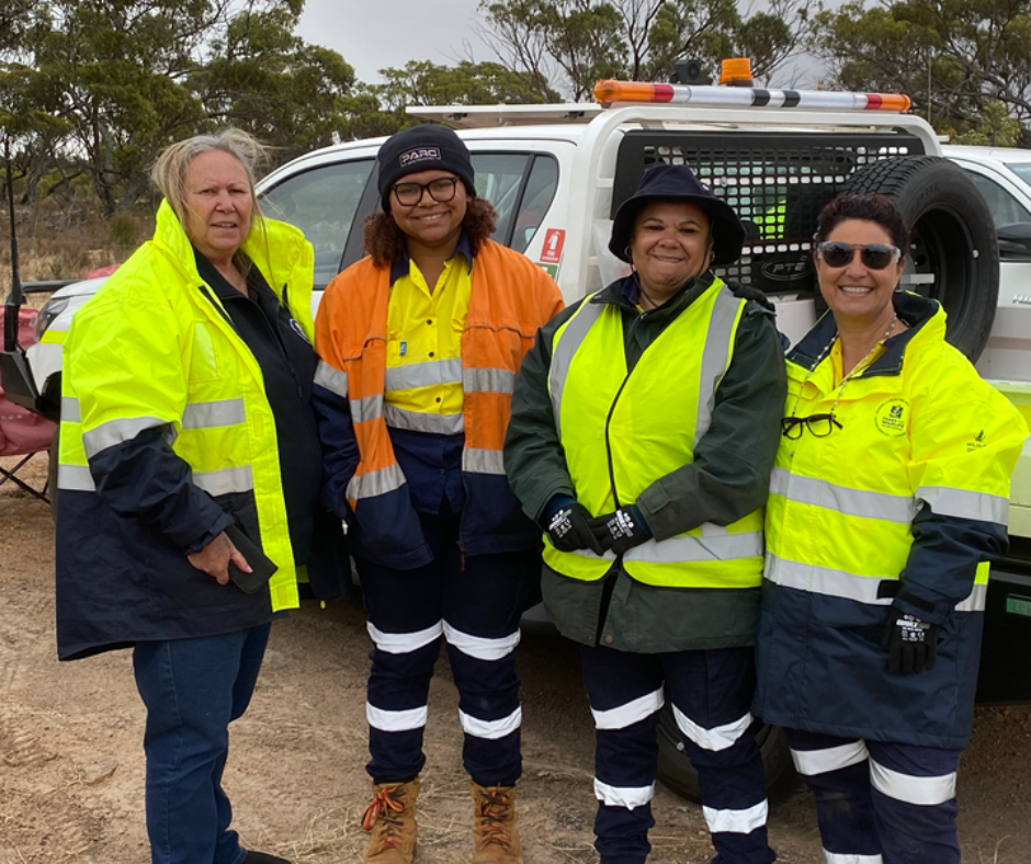
DBCA Aboriginal Engagement Coordinator Michelle Slater with GKB Yorga Rangers Maya Hume, Megan Hill, Sandra Derschow.
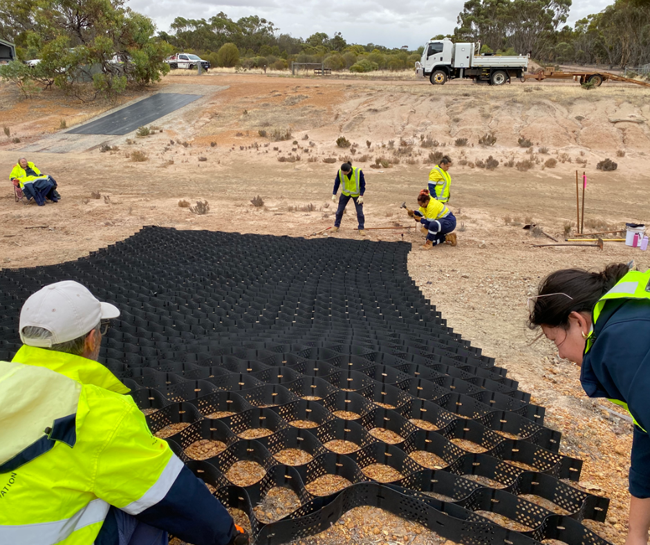
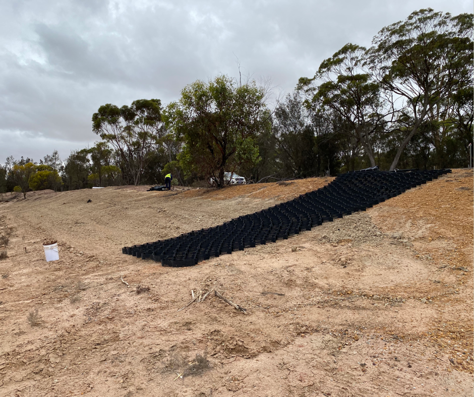
Installation of MiraCell® erosion control on the bund wall.
Lake Toolibin: protecting a freshwater refuge in WA’s Wheatbelt
Important work is underway at Lake Toolibin (Torrbarn) to strengthen the bund wall that protects this internationally-recognised Ramsar-listed wetland.
This project is being delivered on Gnaala Karla Booja Country by South West NRM in partnership with the WA Department of Biodiversity, Conservation and Attractions (DBCA) and Gnaala Karla Booja Aboriginal Corporation (GKB).
The work forms part of a 5-year collaborative project lead by South West NRM with funding from the Australian Government to improve the overall health and function of three Ramsar wetlands in our region.
Work at Lake Toolibin (Torrbarn) is focused on remediation of the lake’s bund wall – a sloped barrier constructed in the 1990s to prevent saline water entering the system.
It works by diverting initial saline runoff following rainfall, allowing flows to be managed before entering the lake.
MiraCell®, the innovative approach to erosion control
To improve the structural integrity of the bund wall and address erosion, a geosynthetic solution called MiraCell® has been installed as a trial across approximately 50m of the site.
This cellular confinement system stabilises soil by limiting lateral movement under load, increasing resistance to surface runoff and erosion. Improved soil retention and slope stability help maintain the bund wall’s integrity over time.
Installation involved placing and securing large panels along the slope, connecting sections and infilling with soil. The surface was then seeded with salt-tolerant samphire seeds to support ongoing stabilisation.
Site context and ecological significance
Lake Toolibin is located approximately 40km east of Narrogin within the Wheatbelt region of Western Australia. Unlike many wetlands in the surrounding landscape, it has remained a fresh brackish (a level of salinity somewhere between fresh water and marine) environment, despite widespread salinisation in the region.
The lake sits approximately one metre above saline groundwater, requiring ongoing management – including measures like groundwater pumps – to prevent saline intrusion.
The wetland at times supports a range of waterbird species, including freckled ducks (Stictonetta naevosa), Eurasian coots (Fulica atra), and Australasian shovelers (Spatula rhynchotis). It also supports a Threatened Ecological Community (TEC) which includes the last large swamp sheoak (Casuarina obesa) and paperbark (Melalueca stropohylla) woodland of the region – a community that was once widespread but has largely declined due to increasing salinity.
Ongoing management
Future works will include the installation of a permanent lake outflow plug structure which allows water to flow out of the lake in a fill event when water in the lake reaches a maximum height, preventing damage to the bund wall.
South West NRM will continue working with GKB and DBCA to support long-term ecological health of Lake Toolibin.
This project is funded by the Australian Government’s Natural Heritage Trust and delivered by South West NRM, a member of the Commonwealth Regional Delivery Partners panel.